I’m ahead of schedule on this journey, as I started out only 11 days ago. I was going to give myself a week in Laverton to get a lift on the Great Central Road but I only had to wait a little more than two days, and I was prepared to spend multiple nights in Warburton or Warakurna on the way to Yulara. Hitchhiking with brisk efficiency has allowed me to spend a couple of nights in Yulara and take my time getting back over to Queensland, as my flight to Papua New Guinea isn’t until 19 May. The other night I ended up at Curtin Springs and last night I ended up at the Tropic of Capricorn, where I pitched my tent and made friends with two Czech couples. I’ve crossed this circle on three different roads in Australia, and now I’ve camped at it. I should add that I’ve never crossed the Tropic of Cancer anywhere except for flying over it. I was up early this morning after hearing someone pull into the rest area, and annoyingly, I forgot to zip up my tent entirely, and I had a mouse crawling round in my tent last night. I tend to be light sleeper when I pitch my tent in places like this because there’s always the potential for dodgy characters to pull up, but it turned out the bloke was on his way to work and was having issue with his radiator. A colleague would later come and tow him out. I sat with the Czech couples this morning and had a coffee with them after all my gear was ready, and though they were heading north, there were only two seats in each vehicle. After waiting for close to an hour, I was picked up by a bloke named Michael heading to Tennant Creek. He’s on his way to Darwin for a work assignment but is staying at a hotel in Tennant Creek, therefore we took our sweet ass time on the way up. We made a quick stop at Ryan Well so I could find my first geocache in the Central Desert Region. Local government areas (LGAs) tend to be very big in the Northern Territory (NT) and I’ve found caches in quite a few of them. We then stopped for a feed in Ti Tree (pronounced like “tie tree”), and further north we stopped in Wycliffe Well, which is Australia's UFO capital. I've always had an interest in UFOs and, in fact, I saw a UFO when I was a small child.
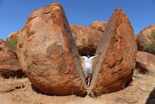
One place that was high on my list for this journey was the Devil’s Marbles. Known as Karlu Karlu by the Indigenous, these massive rocks are believed to have formed more than 1.7 billion years ago! I stopped here briefly when I hitchhiked down the Stuart Highway late in ’14 but my camera was broken, therefore I didn’t get any photos. This time I was so snap happy. There are certain areas of the rocks that the Indigenous prefer that you don’t take photos. It appears here that I just hatched.

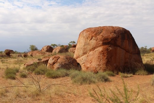
These rocks come in all different shapes and sizes. This one looks like a scoop of rice.

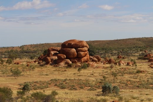
This one looks like a hamburger or perhaps a brioche bun.

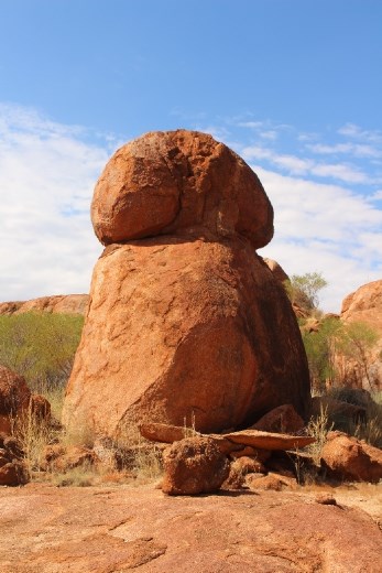
You don't need a degree in nuclear physics to figure out what this looks like...

It's funny there's a virtual geocache here called "Satan's Balls." There are no physical caches either here or at Uluru and Kata Tjuta due to spiritual reasons. More than two hours we spent at the Devil's Marbles, and this time I had no shortage of photos. An hour later, Michael would drop me at Tennant Creek. A most strange place, Tennant Creek isn't a place you'd want to spend too much time.
Today I made it as far as Threeways Roadhouse after it took more than two hours to get there from Tennant Creek. If all goes well, I'll be in Queensland tomorrow.