20/2/10 - 6/3/10 25km hiking and 419km biking (total 21352 km)
Cajas National Park is a high paramo wonderland of stunning lakes, black rocky peaks, glacial valleys, waterfalls, golden grassy vegetation, amazing alpine flora, wildlife of deer, fox, rabbits, birds of prey and importantly home to the andean condor. We couldn´t leave Cuenca without spending three days hiking 25 tough km's through this spectacular Andean wilderness. The scenery of Cajas was at times reminiscent of the south west of Tasmania's button grass plains, or even the moors of Scotland, but, this was the Andes, and a very different face than we have seen and than we will see further south along the mountain chain. The landscape was created by the retreat of the mountain glaciers that worked on inherent weaknesses in the rock carving out huge glacial 'U' shaped valleys, rocky bluffs, cirques and hundreds of alpine lakes that dot the landscape like shimmering jewels.
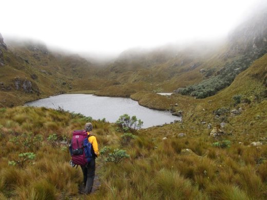
We hiked through mist, rain and finally dry skies through those u-shaped valleys, alongside alpine lakes, through a wonderland of alpine flowers and giant 'Puyas', and camped near raging waterfalls next to Incan ruins. The three day hike was along roughly defined trails or trailess terrain, steep and boggy underfoot which tested our knees and our navigation abilities, and all under the watchful eyes of only buzzard eagles and caracaras (a type of scavenging falcon of the Americas). We experienced a solitude that we haven't felt for a long time in Cajas, a magical but also harsh Andean environment between 3500m and 4500m.
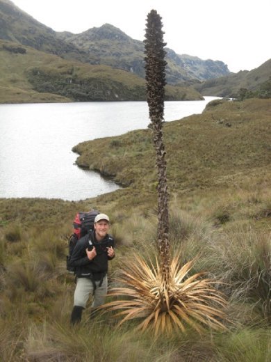
We even had the fortune of spotting an andean condor on our last morning of hiking, flying high above us along a rocky cliff with his imposing wing span and trademark white collar (sorry our photos didn't do it justice so we didn't include them, but we will hopefully get better pics further down the Andes!).
So finally after the hassles with customs, my new internal gear unit for my Rohloff fitted and running as good as new, sickness from food and our hiking sidetrip, after 18 days off the bike we were able to leave Cuenca. Although, the Cajas trip hiking through mud and steep terrain for three days had also aggravated my left knee with swelling and stiffness, and although it was feeling better from two extra days of rest, it was not perfect when we rolled out of Cuenca for the notoriously steep stretch from Cuenca to Vilcabamba.
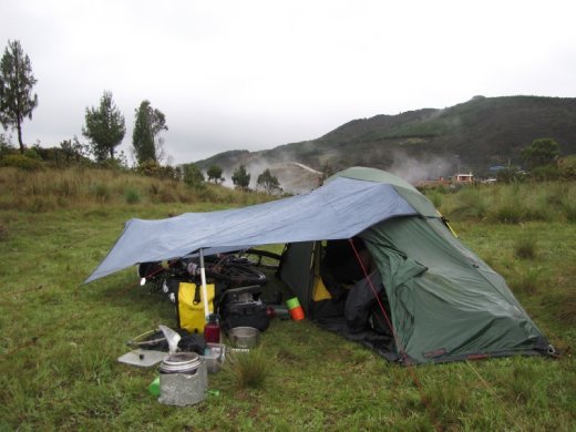
The next days can be best described by wet and extremely hilly on the southern Ecuadorian rollercoaster. Out of Cuenca we climbed 1000m of steep concrete highway up to 3500m into the paramo and the cloud and rain. We ended up camping out in the scrub on the side of the road in the wet and misty conditions at 3100m on the other side of the pass and we had to develop a new strategy for camping in the rain including the tarp and our two ‘anti crazy dog whacking sticks’ to keep the rain out of the tent and our bikes dry.
It was spectacular paramo country above 3000 metres in the south of Ecuador with a surprisingly large amount of low shrubby forest remaining, far more than we had seen in the heavily farmed centre and north of Ecuador (where they would farm up to 3500 - 4000m). This low forest wouldn’t seem out of place in the coastal heathlands of southern Australia, even with some yellow flowering Waratah looking plants from the Proteaceae family, a link back to Gondwanan times when South America, Southern Africa, India, Australia and New Zealand were all connected.
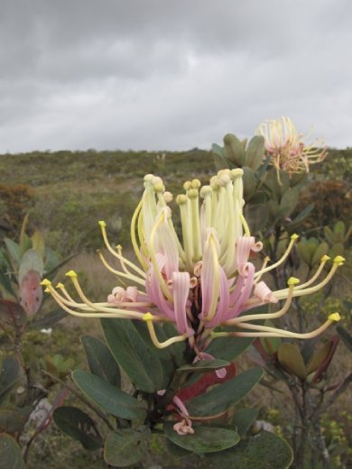
Could be Australia....! Oriocalyx species (relative of the Australian Waratah) on the Ecuadorian paramo above 3000m
The only difference here being the cloud and rain of 3000m of elevation and the buzz of hummingbirds zipping through the heath community visiting the variety of flowering plants up at this altitude.
The next morning on the descent we were admiring the beautiful heath forest scenery, and the smooth flowing downhill riding when a pair of hummingbirds flew out of the forest and straight between Anna’s tyres. Anna pulled up immediately and as I came around the corner behind her I saw one distressed hummingbird flying, and another flapping around on the road. Quickly Anna picked up the delicate green bird, shocked and with maybe a damaged tail it sat still for a number of minutes, its warm little body cupped in Anna’s hands.
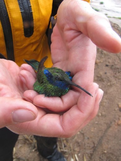
Then it flew off into a tree and rested for another while, before disappearing to hopefully rejoin it’s distressed mate. Luckily it’s wings weren’t broken, as they rely on their wings (beating at 80 times per second) to hover and maneouvre while feeding on nectar rich flowers. We guess only time would tell if it was well enough to survive. Anna felt guilty for what had happened but it was an unfortunate stroke of luck, and if it wasn’t her, it would have been a speeding car.
That descent continued all the way down to 1950 m, crossing over a modest sized river ‘el Rio Leon’ before pointing straight back up the other side and out of the ‘grand canyon of Ecuador’. At this elevation the vegetation had changed back to aloes and mesquite, typical desert vegetation but surprisingly the rain had followed us all the way down to the bottom.
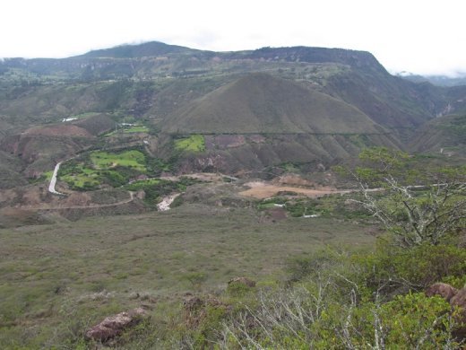
That hill is where we just came from, dropping 1200m in maybe 18km...and then straight back up again!
To give some idea of the nature of the hills and the steepness of the roads, for the past two days of riding we had covered 145 km on steep concrete slab roads (they build bomb-proof roads with 30cm thick slabs of concrete because the gradients are so steep) but had also climbed over 3000m of vertical elevation to end up at the same elevation as Cuenca at 2500 m crossing two significant canyons at 1950m and 2100m and passing over 3500m and 3100m.
One of the saddest things we saw along this stretch of road was an illegal rubbish dump just outside the town of Oña in beautiful canyon country. As we rode closer we noticed a man drive his ute into a layby, back it up to the edge of the canyon and then dump their rubbish onto the steep slopes. This was an eyesore, we could see the trail of debris cascading down the slope into the canyon from kilometres away.
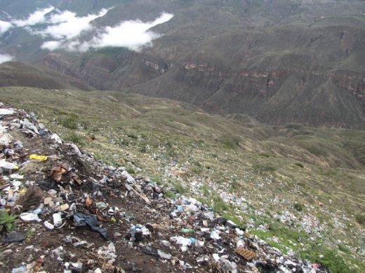
When we asked the man what he was doing, he replied "Well I do it with conscience, but there is no other facility to dispose of our rubbish. It's lamentable I know but where else do I dump it...?". We think, "Rubbish...well maybe there are better places than here in this beautiful canyon...and with what conscience?". We could do nothing but shake our heads at the stupidity of that man and the rubbish dump.
Ali's rant begins: (warning some negative thoughts!) We get asked very often in Ecuador "How do you like Ecuador?..." and before we have time to answer they usually put words in our mouths like "It's beautiful isn't it!" Well actually, after seeing how a lot of Ecuadorians treat their natural areas, and after that encounter outside of Oña, "no". Sure there are beautiful national parks but a place is only as beautiful as it's inhabitants value it for a beautiful natural place. This was a disgrace outside of Oña, a huge dampener on our impression of Ecuador. So a little angry especially after being ripped off by the typical over friendly elderly señora in the restaurant (who act so friendly to you at the start and then grossly over charge you food but because they had been so nice you don't really feel like you can question them ripping you off)we rode out of Oña glad to have it behind us(end of Ali's rant!).
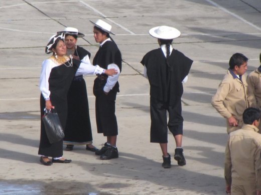
In Saraguro we found some more excellent hospitality from the local bomberos, dried our wet camping things out and watched from our rooftop bedroom the graduation ceremony of the local college. Interestingly the indigenous kids wore their traditional clothing of black knee length trousers, and black dresses for the girls, while the ‘mestizos’ (or mixed spanish indigenous) wear untasteful beige suits. The interesting thing about Saraguro is that this proud and prosperous indigenous group originally came from Lake Titicaca in Peru and Bolivia but were moved here to southern Ecuador in the 1470's as pat of the Inca empires system of re-settlement and they have been here ever since. They hold on to their traditions and Lake Titicaca dress of black bowler hats, black ponchos, black knee length pants and long pleated hair for the men and broad brimmed white hats, pleated black skirts and elaborate beaded collars called chakiras for the women. A real contrast from the indigenous folks of the rest of Ecuador.
Four days riding from Cuenca we arrived in Vilcabamba, famed as the ‘Valley of Longevity’, where in the past a large proportion of the local community lived well into their hundreds due to the climate or the quality of the water who knows? Well whether that was true or not, it now is a magnet for gringos both long termers who have bought property searching for a longer and more tranquil existence in their own piece of paradise, and travellers who come for the good climate, massages, hiking, alternative medicines or to experiment with halucinagenic cactus juice sourced from the local hills. The result is a strange blend, extremely friendly locals in the quiet dirt streets of town, young backpackers wandering aimlessly around town in search of enlightenment, some gringo restaurants, a few ageing hippies and an authentic small town that somehow retains it’s own charm despite the large numbers of travellers and gringo residents.
My theory on Vilcabamba was that it is not the ‘Valley of longevity’, but in fact being there speeds up the ageing process, so people are not actually living longer, but are instead ageing more rapidly. I based my theory on the number of older backpackers or travellers that we saw there. That old hippy with the white beard at the cafe, well he arrived as a young backpacker just 3 months ago and now he’s 75. The middle-aged couple walking through the forest at Rumi Wilco, well they’ve been there for 3 weeks and now they are retired and in their mid 50’s. For this reason, we only stayed a few days...
For us Vilcabamba was a great relaxing place to break the tough ride to the Peruvian border, and get some rest before the next stretch of dirt and hills. We stayed at a place just outside of town called Rumi Wilco Eco-lodge, run by an Argentinian biologist/conservationist couple Alicia and Orlando, who over the past 20 years have worked hard at developing a private reserve adjacent to their property for the conservation of the dry tropical forest and floodplain habitat for birdlife and other wildlife of the area. They have a network of great walking trails throughout the reserve with interpretive signage, great bird watching, as well as adobe cabins, a pole house and a camping area for guests who help support their conservation efforts with what they pay for accomodation. Orlando and Alicia are very knowledgeable and hospitable hosts and provided us one of our best stays in all of Ecuador.
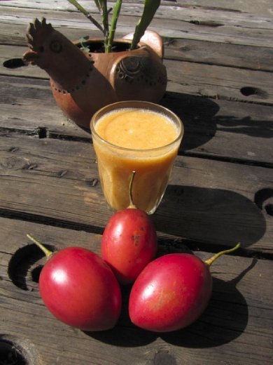
We stayed in one of the adobe cabins, so for two days we did very little but ate home cooked vegetable goodness, drank coffee, enjoyed the birdlife from the cabins, walked some trails and honed our fresh juice making abilities with ‘tomate de arbol’ (tree tomato) and ‘naranjilla’ (a sour orange fruit very similar to kiwi fruit - also called ‘Lulo’ in Colombia) with the luxury of a juice blender in the Rumi Wilco kitchen.
Also staying at Rumi Wilco down at the camping area by the river were Jacinta and Joel, another young cycling couple from France and Belgium who had met on the road in Bolivia. At the time Joel was backpacking, but was soon convinced of the benefits of cycle touring, and maybe a little by the charm of Jacinta, so he bought his bike and all of his gear in Santa Cruz Bolivia and they have been travelling north ever since.
Ian, our English/Canadian cycling friend from Tumbaco had also caught us up in Vilcabamba from where we had planned to ride south towards Peru with the three of us. So it was a ‘ciclista’ gathering of some sorts around the fire with the five of us for dinner at the camping hut at Rumi Wilco sharing good food and tales of the road ahead.
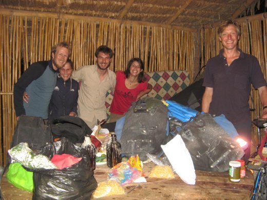
Ali, Anna, Joel, Jacinta and Ian and the ciclista gathering at Rumi Wilco, Vilcabamba
The next three days to the border was great riding on quiet dirt and muddy roads but also incredibly challenging with 10% grade hills being the norm as the road carved its way through hilly terrain dropping and gaining between 300m and 1000m at a time.
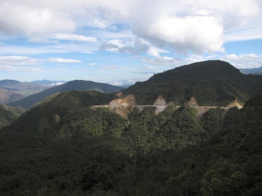
20 km after Vilcabamba the road finally turned to dirt and the hills really got steep. We rode up from 1500m to 2500m and into the cloud forest of Podocarpus National Park where we found a wild camp spot just off the road on about the only flat spot of land.... Spectacular! Our campsite was at the centre-left of picture where the white gravel of the road is sliding into the forest.
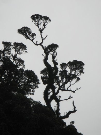
Cloud forest silhouette, Podocarpus NP
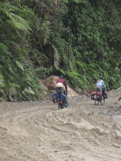
It got pretty sticky in sections coming down from Podocarpus NP, luckily we were heading downhill as there was no way you could ride these sections back up, it was just point the bike in the right direction and slide on through. Fun and challenging riding on a 60 kilo loaded bike!
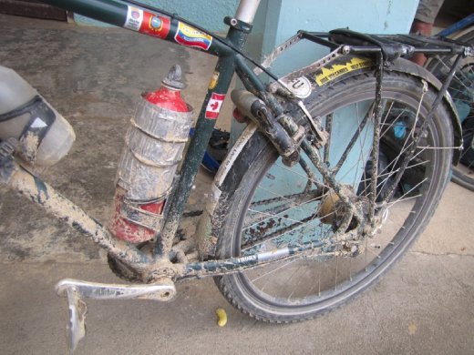
The bikes sure copped some abuse on the last three days from Vilcabamba. Here is Ali's bike in Zumba after the slick mud shower we received while riding through terrential rain and fresh roadworks in the morning.
This road was cut through hastily in time for the opening of the remote international border post at La Balsa as late as 1998 after the border dispute was resolved and a peace treaty signed between Ecuador and Peru. As a result, we don't believe any road engineers were present when they built this ridiculously steep last section to the river at La Balsa. Ecuadorian roads, steep to the bitter end!
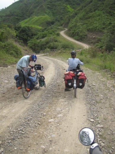
Here Ian and Anna contemplate the last one....doesn't look so bad but the steep pinch right at the end had us digging as deep as we could, but we still didn't get off to walk it!
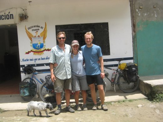
There we are, the three of us at La Balsa checking out of Ecuador, and about to cross the 'friendship bridge' into Peru, glad to have those hard days behind us, but knowing full well just what Peru would also have in store for us, only with much better gradients of roads (or so we have been told).
The border formalities were extremely casual especially on the Peruvian side as we ate lunch at a restaurant we were processed one-by-one by the lone border official who gave us each exactly the days that we asked for, no questions asked, and then we could return to lunch! The most relaxed border crossing of the trip so far.
So with mixed feelings about leaving Ecuador, a country that had provided some amazing backroad adventures around snow-capped volcanoes, through high paramo of huge 'frailejone' daisies, highland villages and markets and then finishing in the southern highlands on secluded mountain roads, and while we were usually greeted with respect, kindness and happy faces and made many new friends (especially at the Casa de Ciclista in Tumbaco with Santiago), we were occasionally frustrated at the rubbish situation, the excessive fees foreigners pay to enter parks, the beaurocracy and the way we were treated by people at times. But all in all we really enjoyed our time in Ecuador, a beautiful country with huge challenges for the adventure cyclist. So with that we exchanged some US dollars for Peruvian Soles, paid considerably less for our restaurant lunch and rode into a relatively new world just a short 8km following the river to the first village of Namballe.
Bienvenidos a Peru! Join us for more stories from the northern highlands of Peru...
Hasta la proxima vez!
Ali and Anna