AUSTRALIA | Saturday, 4 June 2011 | Views [658]
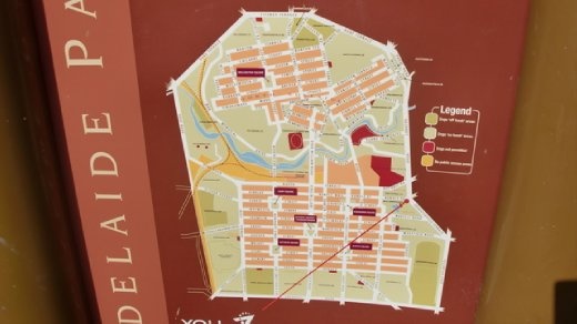
Adelaide is best appreciated by map, which really gives you a sense of what this city is all about. It was laid out starting in the late 1830's by William Light, the city's first Surveyor-General. The locals call it “Light's Vision,” which is still the general term for the city's distinctive look. He envisioned two urban sections, one north (North Adelaide) and one south of the River Torrens (Adelaide City), with the entire area surrounded and immersed by parkland. There are 29 designated parks surrounding the city, divided by roads or natural features, covering about 7.6 square kilometres. Adelaide truly feels like an island in a sea of parks, which is both a wonderful blessing in that it is one of the greenest cities in the world (and very far-sighted for the 1830's), but it also leaves the city feeling cut off and isolated from its suburbs, plus a lot of water is needed to keep the parks from drying up.