People who know me, know that I am generally quite laid back. I hate
a few things though: intolerance, dishonesty, general stupidity. And
mosquitos. Especially mosquitos.
The wind
was gone and the air was filled with a low but constant buzzing noise.
Millions of mosquitos were hovering above the tundra. In Alaska
the mosquitos are not just annoying, they are annoying in very large
quantities and sizes. We were warned about them and fortunately Peter
from Outdoordacht
had supplied us with some Sea to Summit head nets. It might sound
excessive, but unless you have experienced this, you have no idea how
crazy these bugs can drive you.
We had our breakfast inside our tent and then packed quickly and
headed off. We noticed that as long as you were cycling, it was still
reasonably doable, but when stopping, even for a moment, the mozzies would attack. we almost wished for the wind to return, not sure yet, which of the two makes the cycling the hardest.
We found the other cyclist about 15km down the road and said hello.
we would probably be leap-frogging the next few days, but as they used
lighter bikes and had less gear with them, they would probably go faster than us.
Once some welcome clouds came along (it was getting unbearably hot), the grassy tundra looked like Windows wallpaper.
Together with the clouds came also the first gradual hills. Every
now and then there was a bit of paved road and we noticed that just
this simple fact made us extremely happy. It is interesting how
perspective changes on trips like these. Many cyclists and other
travellers talk about their deep thoughts and epiphanies they have on
the road, but frankly, we were mostly just thinking about how to dodge
the next big piece of gravel, the wind
and eating. Eating is the main focus of many a cyclist’s day… maybe our
mind was till full with all the stress of the preparations, but no
deeper thoughts would emerge.. yet?
We cycled more distance this day even though we took it easy. The
gentle breeze was back in our backs again, which made the going a bit
easier. the heat was getting unbearable though and when going uphill on
longer stretches I had to stop to drink and cool down.
We had a nice Adventurefood lunch at a resting area. It consisted of
nothing more than a toilet and a sandy parking space, but a passing
driver that was interested in cycling filled all our bottles up with
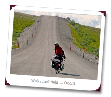
fresh water, and we headed up more hills. It was getting really steep at places and the going was tough. Ivana
is much smarter than i am and just walks when it gets too steep, but
somehow my male hormones make me want to cycle up, even if it means
stopping halfway to catch my breath and energy back.
We reached a place called Happy Valley at the end of the day. Noting
more than an airstrip and some trucks, but the fresh river cooled us
down and some small trees provided shade for cooking dinner. Kayla had
passed us on the way and was already sitting in the stream, but the
other 4 guys only arrived an hour later. I proposed to Ivana
to continue a bit, so maybe the next day we could reach Galbraith Lake,
the place where we had dropped off Curt on the way over. It reportedly
had a nice place to camp and with 50km from the feared Atigun pass, it
would be a nice place to attack the steep Brooks Range from.
We should have stayed like the others did. Not only the wind
turned into our face and we got rained upon heavily within minutes
after leaving, but later we found out that the others were invited to
sleep inside and were treated on all kinds of food. We spend the night
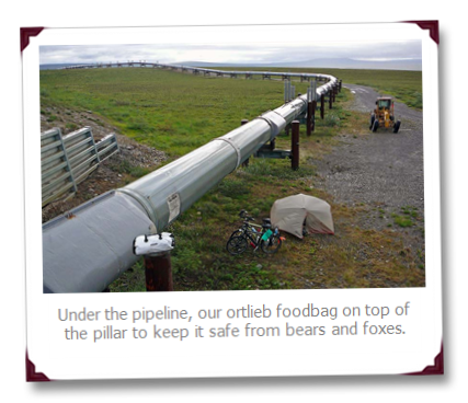
exhausted and grumpy, tired of hills, mud, gravel, mosquitos, wind and rain, camped under the Alyeska Pipeline, the Aorta but also scar of Alaska…
For those who like numbers: 86km cycled, 700m up, 400m down in about
6 hours and a bit. here is our visual overview of today: the main line
is our altitude vs distance, the blue heartrate monitor graph is our
speed (with scale to the right side of the left y-axis; though I do not
remember doing 240km/hr at one point 
You can also see the temperature changes on the line on top (with legend to the right, in degrees Celsius).
