We managed to hitch a lift from Picton to Blenheim, where we had booked a wine-tour through the famous Marlborough wine county, with an English guy who had emmigrated to NZ 15 years ago. He was very friendly and when he spotted us an hour later waiting for the bus to pick us up for our wine tour, he pulled over and offered to take us with him to the beach where he was headed for the afternoon!
The wine tour took us to several different wineries where we sampled lots of different wines, including the sauvingnon blanc which Marlborough is famous for. We were on the tour with 4 medical students from the UK who had just finished their elective in Auckland and were really good company for the afternoon. At the last winery we tasted their wine then had a blind taste so see if we had learnt anything and could identify the mystery wine. John's "mature" palate won the day and he was rewarded with a lollipop for his correct guess! We finished up the tour at a fudge factory (the winery next door was sadly closed for the day) and tasted the most delicious cremem brulee fudge. After an afternoon of wine-drinking our ability to cook dinner was somewhat diminished so we settled for fish and chips with a glass of our newly aqcuired Sauvingnon Blanc and creme brulee fudge for pudding.
The next day we decided to head for Nelson, the access point for the Abel Tasman National Park. We had been told by many people we had met that this was an excellent area for hiking and were keen to see for ourselves! We managed to get a lift to Renwick and were then picked up by John, who agreed to drop us in Nelson. We chatted for most of the journey, discovering that he was a builder by trade who owned a small farm in the hills with his partner near the Abel Tasman National Park. He was very friendly, and as we approached Nelson he asked us back to his house for a cup of tea and said he could drop us in Motueka, even closer to the start of the trail. We arrived and met Liz and Miley the Huntaway dog. We had a cup of tea with them, after which they invited us to stay for dinner and then the night. They were lovely company and we really enjoyed taking Miley for a walk round their picturesque farm (where she caught a rabbit, which had to be skinned and gutted before she would eat it). John is currently building a beautiful house with wonderful views, how lovely to have useful skills! (Scientific research not being renowned for its usefulness in everyday life!!). John also had several old cars he was rennovating and some dirt bikes.
John dropped us in Motueka the next day and we set about buying supplies for our hike. There are two trails in the Abel Tasman National Park, the extremely popular coastal track, and the harder and not so crowded inland trail. We decided to go for the inland trail as we'd already hiked the Queen Charlotte Trail, which is on the coast, and to try to get away from people a little bit.
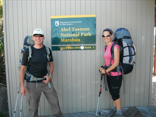
We caught the bus from Motueka the next day to the start of the trail and set off accross the Motueka estuary.

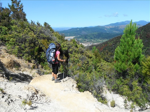
We turned off after about 3km to the inland trail, which climbed steadily higher with lovely views over the Abel Tasman coast.

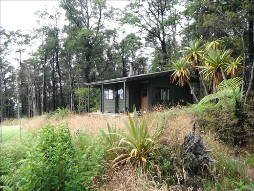
The hiking was really hard and we were climbing up stream beds, over tree roots and over boulders. This was aggravated by the fact that we had brought loads of food....we'd been a bit hungry on the Queen Charlotte Trail and were determined that this would not be the case this time!!. We arrived at Castle Rocks Hut and pitched the tent in the grasslands. An American couple, Casey and Melissa, were staying in the hut and we wandered over to eat dinner with them. They were both planetary scientists and as we sat outside the hut in the fading light, they pointed out some of the emerging stars, and Melissa and Sarah commiserated one anither on the undertaking of a PhD!
We woke up the next morning exhausted. An examination of the map showed that we could reach the very basic Moa Park Shelter in 2 hours.... we made it in 3 - it was only 3.5km! We flopped down outside the hut and decided we wouldn't go any further that day. After lunch Sarah promptly got into her sleeping bag and went to sleep for the afternoon whilst John read and then investigated the grassy plateau we were on. After dinner we set our mats up on the floor of the shelter...who said romance is dead??? (the shelter had been downgraded from a hut and therefore the bunks had been removed).

Feeling lovely and refreshed (but a bit chilly)the next day we awoke to see our breath condense as we looked around our luxury abode! It was obviously a bit colder at these higher elevations and a steaming hot coffee was required before any hiking! However, once we got going we were on more level ground all the way to Awapoto Hut, where we pitched the tent and spent an hour reading in the sunshine. A really lovely couple, Kirsty and James from Bristol, were staying in the hut and they soon got a very welcome fire going. We ate dinner inside, chatting to them and to a French guy and his Quebecy girlfriend. Andre has travelled to New Zealand via Burma and it was really interesting hearing his experiences there.

The final day was blessedly downhill! It was positively easy! We only lost the trail once, on a steep downhill section, and were quickly swallowed by the forest, ourselves and our bags getting trapped by creepers growing through the forest.....but we quickly found the trail again. We slowly decended to a road where a huge landslip had taken place and we had to edge round. Just before Christmas, the Abel Tasman area had a huge amount of rain, resulting in lots of landslips. On this particular road, a family were traveling in a car to a campsite on the coast when one landslip occurred behind them and another ahead of them. Apparantly their car is still trapped there, although they were taken to safety. It was interesting to note that there is much controversy over whether there is sufficient money and justification to repair the road (the only road into this area of the coast).... we have travelled along many scary mountainous roads in Laos that were continuously affected by landslips and rockfalls and in Laos where they are not "hindered" by any health and safety regulations and where lives rely on the open roads, these roads just "get fixed" quickley and with no obvious signs of any system or method. This entails many bulldozers, diggers and probably very minimally qualified Laos workmen flattening a new bit of the mountain side just wide enough to get the bus you are travelling on past the landslip/rocfall! You then edge past very, very slowly!
We followed a path which led from the inland trail down onto the coastal trail. We arrived at Totaranui camp site that evening and just managed to pitch the tent before the rain came down. We were considering hiking back to the start of the trail along the coast track but decided to see what the weather would be like the next day.
Predictably, the next day we woke to torrential rain. As the road was closed due to the landslips, the only option to get back to the trail beginning was by watertaxi. Fortunately they just turn up on the beaches at certain times during the day so we managed to get on one within half an hour. We then hung on for dear life as we shot through the water, stopping at each bay on the way, before we were dragged out of the water and driven along the road to the taxi office by a tractor!
